Category Archives: open data

Open Data Day 2011 – Recaps from Around the World

This last Saturday was International Open Data Day with hackathons taking place in cities around the world.

How many you ask? We can’t know for certain, but organizers around the world posted events to the wiki in over 50 cities around the world. Given the number of tweets with the #odhd hashtag, and the locations they were coming from, I don’t think we were far off that mark. If you assume 20 people at each event (some had many more – for instance there were over 100 in Ottawa, Vancouver had close to 50, 120+ in New York) it’s safe to say more than 1000 people were hacking on open data projects around the world.

It’s critical to understand that Open data Day is a highly decentralized event. All the work that makes it a success (and I think it was a big success) is in the hands of local organizers who find space, rally participants, push them to create stuff and, of course, try to make the day as fun as possible. Beyond their hard work and dedication there isn’t much, if any, organization. No boss. No central authority. No patron or sponsor to say thank you. So if you know any of the fine people who attended, or even more importantly, helped organize an event, please shake their hand or shoot them a thank you. I know I’m intensely grateful to see there are so many others out there that care about this issue, that want to connect, learn, meet new people, have fun and, of course, make something interesting. Given the humble beginnings of this event, we’ve had two very successful years.

So what about the day? What was accomplished? What Happened?

Government Motivator

I think one of the biggest accomplishments of Open Data Day has been how it has become a motivator – a sort of deadline – for governments keen to share more open data. Think about this. A group of volunteers around the world is moving governments to share more data – to make public assets more open to reuse. For example, in Ireland Fingal County Council released data around trees, parking, playing pitches & mobile libraries for the day. In Ontario, Canada the staff for the Region of Waterloo worked extra hard to get their open data portal up in time for the event. And it wasn’t just local governments. The Government of BC launched new high value data sets in anticipation of the event and the Federal Government of Canada launched 4000 new data sets with International Open Data Day in mind. Meanwhile, the open data evangelist of Data.gov was prepared to open up data sets for anyone who had a specific request.

While governments should always be working to make more data available I think we can all appreciate the benefits of having a deadline, and Open Data Day has helped become just that for more and more governments.

In other places, Open Data Day turns into a place where governments can converse with developers and citizens about why open data matters, and do research into what data the public is interested in. This is exactly what happened in Enschede in the Netherlands where local city staff worked with participants around prioritizing data sets to make open.

Local Events & Cool Hacks

A lot of people have been blogging about, or sharing videos of, Open Data Day events around the world. I’ve seen blog posts and news articles on events in places such as Madrid, Victoria BC, Oakland, Mexico City, Vancouver, and New York City. If there are more, please email them to me or post them on the wiki.

I haven’t been able to keep track of all the projects that got worked on, but here are a sampling of some that I’ve seen via twitter, the wiki and other forums:

Hongbo: The Emergency Location Locator

In Cotonou, Benin the open data day participants developed a web application called Hongbo the Goun word for “Gate.” Hongbo enables users to locate the nearest hospital, drugstore and police stations. As they noted on the open data day wiki, the data sets for this application were public but not easily accessible. They hope Benin citizen can use it quickly identify who to call or where to go in emergencies.

Tweet My Council

In Sydney, Australia participants created Tweetmycouncil. A fantastic simply application that allows a user to know which jurisdiction they are standing in. Simply send a tweet to the hashtag #tmyc and the app will work where you, what council’s jurisdiction you are in and send you a tweet with the response.

Mexican Access to Information Tracker

In Mexico City one team created an application to compare Free of Information requests between different government departments. This could be a powerful tool for citizens and journalists. (Github repo)

Making it Easier for the Next Guy

Another project out of Mexico City, a team from Oaxaca created an API that creates a json file for any public data set. Would be great for this team to connect with Max Ogden and talk about Gut.

Making it Even Easier for the Next Guy

Speaking of, Max Ogden in Oakland shared more on Gut, which is less of a classic app then a process that enables users to convert data between different formats. It had a number of people excited including open data developers at other locations such as Luke Closs and Mike West.

Mapping Census Data in Barcelona

A team of hackers in Barcelona mapped census tracts so they could be visualized, showing things, like say, the number of parks per census tract. You can find the data sets they used in Google Fusion Tabels here.

Foreign Aid Visualizations

In London UK and in Seattle (and possibly other places) developers were also very keen on the growing amount of aid data being made available and in a common structure thanks to IATI. In Seattle developers created this very cool visualization of US Aid over the last 50 years. I know the London UK team has visualizations of their own they’d like to share shortly.

Food Hacking!

One interesting thing about Open Data Day is how it bridges some very different communities. One of the most active are the food hackers which came out in force in both New York and Vancouver.

In New York a whole series of food related tools, apps and visualization got developed, most of which are described here and here. The sheer quantity of participants (120+) and projects developed is astounding, but also fantastic is how inclusive their event is, with lots of people not just working on apps, but analyzing data and creating visualizations to help others understand an issue they share a common passion for: the Food Bill. Please do click on those links to see some of the fun visuals created.

The Ultimate Food API

In Vancouver, the team at FoodTree – who hosted the hackathon there – focused on shipping an API for developers interested in large food datasets.  You can find their preliminary API and datasets in github. You can also track the work they’ve done on their Open Food Wiki.

Homelessness

In Victoria, BC a team created a map of local walk-in community services that you can check out at http://ourservices.ca/.

BC Emergency Tweeting System

Another team in Victoria, BC focused on creating twitter hashtags for each official place in the province with the hopes that the province’s Provincial Emergency Program.

Mapping Shell’s Oils Spills in Nigeria

The good people at the Open Knowledge Foundation worked on getting a ton more data into the Datahub, but they also had people learning how to visualize data, one of whom created this visualization of oil spills in Nigeria. Always great to see people experimenting and learning!

Mapping Vancouver’s Most Dangerous Intersections for Bikes

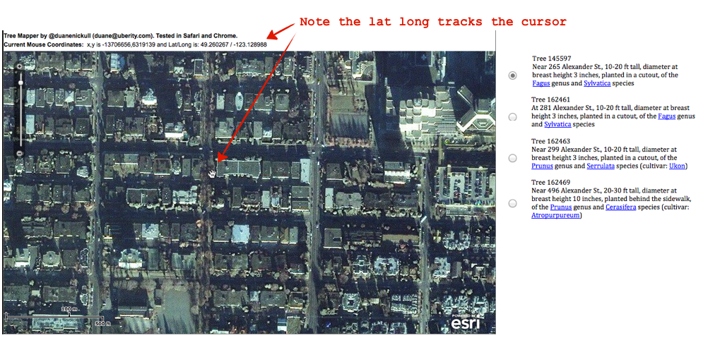
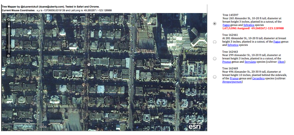
Open Data hacking and biking accident data have a long history together and this hackathon I uploaded 5 years worth of bike accident I managed to get from ICBC to Buzzdata. As a result – even though I couldn’t be present in Vancouver – two different developers took it and mapped it. You can see @ngriffithshere and @ericp’s will be up soon. It was interesting to learn that Broadway and Cambie is the most dangerous intersection in the city for cyclists?

Looking Forward

Last year open data day attracted individual citizens: those with a passion for an issue (like food) or who want to make their government more effective or citizens lives a little easier. However, this year we already started to see the community grow – the team at Socrata hosted a hackathon at their offices in Seattle. Buzzdata had people online trying to help people share their data. In addition to these private companies some of the more established non-profits were out in force. The Open Knowledge Foundation had a team working on making openspending.org more accessible while MySociety helped a team in Canada set up a local version of MapIt.

For those who think that open data can change the world or, even build medium sized economic ecosystems, over night, we need to reset their expectations. But it is growing. No longer are participants just citizens and hacktavists – there are real organizations and companies participating. Few, but they are there. My hope is that this trend will continues. That open data day will continue to have meaning for individuals and hackers but will also be something that larger more established organizations, non-profits and companies will use as a rallying point as well. Something to shoot for next year.

Feedback

As I mentioned at the beginning, Open Data Day is a very decentralized event. We are, of course, not wedded to that approach and I’d love to hear feedback from people, good or bad, about worked or didn’t work. Please do feel free to email me, post it to the mailing list or simply comment below.


Postscript

Finally, some of you may have noticed I became conspicuously absent on the day. I want to apologize to everyone. My partner went into labour on Friday night and so by early morning Saturday it was obvious that my open data day was going to be spent with her. Our baby was 11 days over due so we really thought that we’d be in the clear by Dec 3rd… but our baby had other plans. The good news is that despite 35 hours of labour, baby and boy are doing well!

StatsCan's free data costs $2M – a rant

So the other day a reader sent me an email pointing me to a story in iPolitics titled “StatsCan anticipates $2M loss from move to open data” and asked me what I thought.

Frustrated, was my response.

$2M is not a lot of money. Not in a federal budget of almost $200B.  And, the number may have been less. The StatsCan person quoted in the article called this expected loss of revenue a “maximum net loss.” This may mean that the loss from making the data free does not take into account the fact the StatsCan’s expenditures may also go down. For instance, if StatsCan no longer has to handle as many financial transactions or chase down invoices and so forth, the reduction if staff over other overhead (unrelated to its core mission by the way) and so result in lower operating costs not reflected in the $2M cited above.

Moreover it is still unclear to me where the $2M figure comes from. As I noted in a blog post earlier this year, in StatsCan’s own reports it outlined that its online database (the one just made free) generated $559,000 in revenue (not profit) in 2007-08 and was estimated to generate $525,000 in revenue in 2010-11. Where does the extra $1.5M come from? I’m open to the fact that I’m reading these reports incorrectly… but it is hard to see how.

But all this is really an aside.

What really, really, really, frustrates me is that the hard number of $2M. It is a pittance.

This is the unbearable cost that’s been holding up open StatsCan data for years? This may be the tiniest golden goose ever killed. Maybe more like a lame duck. Can anyone believe the loss of $2M (or 500K) was going to break the organization?

Give me a break.

What a colossal lack of imagination and sense of economic and social prosperity on the part of every government since Mulroney (who made StatsCan engage in cost recovery). In the United States open statistical data has helped businesses, the social sector, local and state governments, as well as researchers and academics. Heck, even Canadian teachers tell me that they’ve been forced to train students on US data because they couldn’t afford to train their students on Canadian data. All this lost innovation, efficiency, jobs and social benefits for a measly $2M dollars (if that). Oh lack of vision, at all levels! Both at the top of the political order, and within StatsCan, which has been reluctant to go down this route for years.

Now that we see the “cost” this battle seems more pathetic than ever.

Sigh. Rant over.

Using Open Data to Map Vancouver’s Trees

This week, in preparation for the International Open Data Hackathon on Saturday, the Vancouver Parks Board shared one neighborhood of its tree inventory database (that I’ve uploaded to Buzzdata) so that we could at least see how it might be leveraged by citizens.

What’s interesting is how valuable this data is already (and why it should be open). As it stands this data could be used by urban landscape students and architects, environmentalists, and of course academics and scientists. I could imagine this data would even be useful for analyzing something as obtuse as the impact of the tree’s Albedo effect on the city’s climate. Of course, locked away in the city’s data warehouse, none of those uses are possible.

However, as I outlined in this blog post, having lat/long data would open up some really fun possibilities that could promote civic engagement. People could adopt trees, care for them, water them, be able to report problems about a specific tree to city hall. But to do all this we need to take the city’s data and make it better – specifically, identify the latitude and longitude of each tree. In addition to helping citizens it might make the inventory more use to the city (if they chose to use it) as well as help out the other stakeholders I outlined above.

So here’s what I’ve scoped out would be ideal to do.

Goal

Create an app that would allow citizens to identify the latitude and longitude of trees that are in the inventory.

Data Background

A few things about the city’s tree inventory data. While they don’t have an actual long/lat for each individual tree, they do register trees by city address. (Again, you can look at the data yourself here.) But this means that we can narrow the number of trees down based on proximity to the user.

Process

So here is what I think we need to be able to do.

  1. Convert the addresses in the inventory into a format that can be located within Google Maps
  2. Just show the trees attached to addresses that are either near the user (on a mobile app), or near addresses that are currently visible within Google Maps (on a desktop app).
  3. Enable the user to add a lat/long to a specific tree’s identification number.

Awesome local superstar coder/punk rock star Duane Nickull whipped together a web app that would allow one to map lat/longs. So based on that, I could imagine at desktop app that allows you to map trees remotely. This obviously would not work for many trees, but it would work for a large number.

Tree-MApper-Screen-shot-11

You’ll notice in the right-hand corner, I’ve created an illustrative list of trees to choose from. Obviously, given the cross-section of the city we are looking at, it would be much longer, but if you were zoomed in all the way I could imagine it was no longer than 5-20.

I’ve also taken the city’s data and parsed it in a way that I think makes it easier for users to understand.

tree-language-parsed

This isn’t mind-blowing stuff, but helpful. I mean who knew that dbh (diameter at breast height) was an actual technical term when measuring tree diameters! I’ve also thrown in some hyperlinks (it would be nice to have images people can reference) so users can learn about the species and ideally, even see a photo to compare against.

Tree-Mapper-Screenshot-2

So, in short, you can choose a tree, locate it in Google Maps and assign a lat/long to it. In Google Maps where you can zoom even closer than ESRI, you could really pick out individual trees.

In addition to a desktop web app, I could imagine something similar for the iPhone where it locates you using the GPS, identifies what trees are likely around you, and gives you a list such as the one on the right hand side of the screenshot above, the user then picks a tree from the list that they think they’ve identified, stands next to the tree and then presses a button in the app that assigns the lat/long of where they are standing to that tree.

Canada’s Foreign Aid Agency signs on to IATI: Aid Data get more transparent

Last night, while speaking at the High Level Forum on Aid Effectiveness in Busan Korea, Minister of International Cooperation Bev Oda announced that Canada would be signing on to the International Aid Transparency Initiative (IATI).

So what is IATI and why does this matter?

IATI has developed a common, open and international standard for sharing foreign aid data. By signing on to IATI Canada is agreeing to publish all the data about its projects and who it funds in a form and structure that makes it easy to compare with others who use the IATI standard. This should make it easier to understand where Canadian aid money ends up, in turn allowing analysts to spot efficiencies as well as compare funding and efforts across donor and recipient countries as well as other stakeholders. In short, aid data should become easier to understand, to compare, and to use.

In the medium term it should also make the data available on CIDA’s open data portal (already helpful to non-profits, development groups and students) even more useful.

This is an enormous win for the good people at Engineers Without Borders, as well as the team at Publish What You Fund. Both groups have been working hard for over a year talking Canadian politicians and public servants through the ins and outs – as well as the benefits – of signing onto IATI. I’ve been working with both groups as well, pushing IATI when meeting with Federal Ministers (I recommended we make it part of our Open Government Partnership goals) as well as writing supportive op-eds in newspapers, so needless to say I’m excited about this development.

This really is good news. As governments become increasingly aware of the power data can have in facilitating cooperation and coordination as well as in improving effectiveness and efficiency, it will be critical to push standards around structuring and sharing data so that such coordination can happen easily across and between jurisdictions. IATI is a great example of such an effort and I hope there are more of these, with Canada taking an early lead, in the months and years ahead.


International Open Data Hackathon, Dec 3rd. It's coming together.

So a number of things have started to really come together for this Saturday Dec 3rd. I’ve noticed a number of new cities being tweeted about (hello Kuala Lumpur & Oakland!) and others adding themselves to the wiki. Indeed, we seem to be above 40 cities. It is hard to know how many people will be showing up in each given city, but in Vancouver I know that we already over 20 registered, while in Ottawa they are well above 40. If other cities have similar numbers it’s a great testament to the size of the community out there interested in playing with open government data.

A few thoughts to share with people as we get ready for the big day.

1. Leverage existing projects.

I’ve mentioned a few times that there are some great existing projects out there that can be easily leveraged.

In that vein I’ve noticed the good people at the Open Knowledge Foundation, who are behind OpenSpending (the project that powers WherDoesMyMoneyGo.org) have not only made their software easier to use but have put up some helpful instructions for creating your own instance up on the wiki. One hope I have for Saturday is that a number of different places might be able to visualize local budgets in much easier to understand ways. OpenSpending has the potential of being an enormously helpful tool for communities trying to understand their budget – hopefully we can provide some great examples and feedback for its creators.

In addition, the folks at MySociety have provided some helpful advice on the wiki for those interested in spinning up a version of MapIt for their country.

2. Get Data Now, Not on Saturday!

Here in Vancouver, my friend Luke C asked if we could get bicycle accident data for the city or province as he wanted to play around with it and maybe visualize it on December 3rd. It just so happened I had a contact at the Insurance Company of British Columbia (ICBC) which insures every vehicle in the province. I reached out and, after going through their request process, now have the data set to share with Luke.

The key piece here: now is the time to check and see if data you are interested in is available, see investigate what is out there, and request it from various stakeholders if it is not.

3. Share Your Code, Share your Data

Indeed, one advantage of having the BC bicycle accident data early is that I can start sharing it with people immediately. I’ve already uploaded the data set (all 6400 lines) onto BuzzData’s site here so others can download it, clone it, and share their own work on it. That way, even if Luke and I get separated, he’s still got something to hack on!

So please do let people know where they can find data you are hacking on, as well as project you’re hacking on. The Open Data Day Projects 2011 wiki page currently sits empty (as should be expected). But take a swing by the page 2010 project page, notice how it is quite full… I’d love to see us replicate this success. I’m hoping people link to not just their projects, but also Github repos, scraperwiki creations, BuzzData accounts and other places.

If you have a project and you think people in open data day hackathons in other cities might be interested, put it in the project page and tweet about it using the #odhd hashtag. You may discover there are people out there who feel as passionately about your project as you do!

4. Let’s Get Connected

Speaking of sharing, my friend Edward O-G, who is organizing the hackathon in Ottawa, did a great job last year setting up some infrastructure so people from different hackathons could video conference with one another. This year I think we’ll try using Google hangouts on google+. However, there is a non-trivial risk that this will not scale super well.

So…

Edward also suggested (brilliantly) that people create YouTube videos of whatever they create during the hackathon or in the days and weeks that follow. Please post those links to the Open Data Day Projects 2011 wiki page as well. There were a few projects last year that had youtube videos and they were very helpful, particularly when a project isn’t quite ready for prime time. It gives us a taste of what will be available. It also becomes something we can point people to.

5. Have Fun, Do What Is Interesting

Remember, Open Data Day is about meeting people, learning about open data, and working on something that you feel passionate about. This is all very decentralized and informal – no one is going to come and save your hackathon… it is up to you! So make sure you find something you think is worth caring about and work on it. Share your idea, and your passion, with others, that’s what makes this fun.

Can’t wait to hear what people are up to. Please feel free to email or tweet at me what you’re working on. I’d love to hear about it and blog about them.


Here in Vancouver, the open data hackathon will be happening at the offices of FoodTree, which has some of its own developers working on Open Food data.(If you haven’t signed up yet, definitely do so here).


Statistics Canada Data to become OpenData – Background, Winners and Next Steps

As some of you learned last night, Embassy Magazine broke the story that all of Statistics Canada’s online data will not only be made free, but released under the Government of Canada’s Open Data License Agreement (updated and reviewed earlier this week) that allows for commercial re-use.

This decision has been in the works for months, and while it does not appear to have been formally announced, Embassy Magazine does appear to have managed to get a Statistics Canada spokesperson to confirm it is true. I have a few thoughts about this story: Some background, who wins from this decision, and most importantly, some hope for what it will, and won’t lead to next.

Background

In the embassy article, the spokesperson claimed this decision had been in the works for years, something that is probably technically true. Such a decision – or something akin to it – has likely been contemplated a number of times. And there have been a number of trials and projects that have allowed for some data to be made accessible albeit under fairly restrictive licenses.

But it is less clear that the culture of open data has arrived at StatsCan, and less clear to me that this decision was internally driven. I’ve met many a Statscan employee who encountered enormous resistance while advocating for data open. I remember pressing the issue during a talk at one of the department’s middle managers conference in November of 2008 and seeing half the room nod vigorously in agreement, while the other half crossed it arms in strong disapproval.

Consequently, with the federal government increasingly interested in open data, coupled with a desire to have a good news story coming out of statscan after last summer census debacle, and with many decisions in Ottawa happening centrally, I suspect this decision occurred outside the department. This does not diminish its positive impact, but it does mean that a number of the next steps, many of which will require StatsCan to adapt its role, may not happen as quickly as some will hope, as the organization may take some time to come to terms with the new reality and the culture shift it will entail.

This may be compounded by the fact that there may be tougher news on the horizon for StatsCan. With every department required to have submitted proposal to cut their budgets by either 5% and 10%, and with StatsCan having already seen a number of its programs cut, there may be fewer resources in the organization to take advantage of the opportunity making its data open creates, or even just adjust to what has happened.

Winners (briefly)

The winners from this decision are of course, consumers of statscan’s data. Indirectly, this includes all of us, since provincial and local governments are big consumers of statscan data and so now – assuming it is structured in such a manner – they will have easier (and cheaper) access to it. This is also true of large companies and non-profits which have used statscan data to locate stores, target services and generally allocate resources more efficiently. The opportunity now opens for smaller players to also benefit.

Indeed, this is the real hope. That a whole new category of winners emerges. That the barrier to use for software developers, entrepreneurs, students, academics, smaller companies and non-profits will be lowered in a manner that will enable a larger community to make use of the data and therefor create economic or social goods.

Such a community, however, will take time to evolve, and will benefit from support.

And finally, I think StatsCan is a winner. This decision brings it more profoundly into the digital age. It opens up new possibilities and, frankly, pushes a culture change that I believe is long over due. I suspect times are tough at StatsCan – although not as a result of this decision – this decision creates room to rethink how the department works and thinks.

Next Steps

The first thing everybody will be waiting for is to see exactly what data gets shared, in what structure and to what detail. Indeed this question arose a number of times on twitter with people posting tweets such as “Cool. This is all sorts of awesome. Are geo boundary files included too, like Census Tracts and postcodes?” We shall see. My hope is yes and I think the odds are good. But I could be wrong, at which point all this could turn into the most over hyped data story of the year. (Which actually matters now that data analysts are one of the fastest growing categories of jobs in North America).

Second, open data creates an opportunity for a new and more relevant role for StatsCan to a broader set of Canadians. Someone from StatsCan should talk to the data group at the World Bank around their transformation after they launched their open data portal (I’d be happy to make the introduction). That data portal now accounts for a significant portion of all the Bank’s web traffic, and the group is going through a dramatic transformation, realizing they are no longer curators of data for bank staff and a small elite group of clients around the world but curators of economic data for the world. I’m told a new, while the change has not been easy, a broader set of users have brought a new sense of purpose and identity. The same could be true of StatsCan. Rather than just an organization that serves the government of Canada and a select groups of clients, StatsCan could become the curators of data for all Canadians. This is a much more ambitious, but I’d argue more democratized and important goal.

And it is here that I hope other next steps will unfold. In the United States, (which has had free census data for as long as anyone I talked to can remember) whenever new data is released the census bureau runs workshops around the country, educating people on how to use and work with its data. StatsCan and a number of other partners already do some of this, but my hope is that there will be much, much more of it. We need a society that is significantly more data literate, and StatsCan along with the universities, colleges and schools could have a powerful role in cultivating this. Tracey Lauriault over at the DataLibre blog has been a fantastic advocate of such an approach.

I also hope that StatsCan will take its role as data curator for the country very seriously and think of new ways that its products can foster economic and social development. Offering APIs into its data sets would be a logical next step, something that would allow developers to embed census data right into their applications and ensure the data was always up to date. No one is expecting this to happen right away, but it was another question that arose on twitter after the story broke, so one can see that new types of users will be interested in new, and more efficient ways, of accessing the data.

But I think most importantly, the next step will need to come from us citizens. This announcement marks a major change in how StatsCan works. We need to be supportive, particularly at a time of budget cuts. While we are grateful for open data, it would be a shame if the institution that makes it all possible was reduced to a shell of its former self. Good quality data – and analysis to inform public policy – is essential to a modern economy, society, and government. Now that we will have free access to what our tax dollars have already paid for, let’s make sure that it stays that way, by both ensure it continues to be available, and that there continues to be a quality institution capable of collecting and analyzing it.

(sorry for typos – it’s 4am, will revise in the morning)

The New Government of Canada Open Data License: The OGL by another name

Last week the Minister Clement issued a press release announcing some of the progress the government has made on its Open Government Initiatives. Three things caught my eye.

First, it appears the government continues to revise its open data license with things continuing to trend in the right direction.

As some of you will remember, when the government first launched data.gc.ca it had a license that was so onerous that it was laughable. While several provisions were problematic, my favourite was the sweeping, “only-make-us-look-good-clause” which, said, word for word: “You shall not use the data made available through the GC Open Data Portal in any way which, in the opinion of Canada, may bring disrepute to or prejudice the reputation of Canada.”

After I pointed out the problems with this clause to then Minister Day, he managed to have it revoked within hours – very much to his credit. But it is a good reminder to the starting point of the government license and to the mindset of government Canada lawyers.

With the new license, almost all the clauses that would obstruct commercial and non-profit reuse have effectively been eliminated. It is no longer problematic to identify individual companies and the attribution clauses have been rendered slightly easier. Indeed, I would argue that the new license has virtually the same constraints as the UK Open Government License (OGL) and even the Creative Commons CC-BY license.

All this begs the question… why not simply use the language and structure of the OGL in much the same manner that British Columbia Government tried to with its own BC OGL? Such a standardized license across jurisdictions might be helpful, it would certainly simply life for think tanks, academics, developers and other users of the data. This is something I’m pushing for and hope that we might see progress on.

Second, the idea that the government is going to post completed access to information (ATIP) requests online is also a move in the right direction. I suspect that the most common ATIP request is one that someone else has already made. Being able to search through previous requests would enable you to find what you are looking for without having to wait weeks or make public servants redo the entire search and clearing process. What I don’t understand is why only post the summaries? In a digital world it would be better for citizens, and cheaper for the government to simply post the entire request whenever privacy policies wouldn’t prevent it.

Third, and perhaps most important were the lines noting that “That number (of data sets) will continue to grow as the project expands and more federal departments and agencies come onboard. During this pilot project, the Government will also continue to monitor and consider national and international best practices, as well as user feedback, in the licensing of federal open data.”

This means that we should expect more data to hit the site. I seems as though more departments are being asked to figure out what data they can share – hopefully this means that real, interesting data sets will be made public. In particular one hopes that data sets which legislation mandates the government collect, will be high on the list of priorities. Also interesting in this statement is the suggestion that the government will consider national and international best practices. I’ve talked to both the Minister and officials about the need to create common standards and structures for open data across jurisdictions. Fostering and pushing these is an area where the government could take a leadership role and it looks like there may be interesting in this.


If you are in Vancouver Vote Open Data, Vote Vision

If you are a Vancouver resident tomorrow is election day. I’m hoping if you are a resident and a reader of this blog, you’ll consider voting for Vision Vancouver.

As many of you know just over two years ago the city launched Vancouver’s Open Data portal – the first of its kind in Canada and the second municipal open data portal in the World.

This didn’t happen by chance. It took leadership from politicians who were a) willing to see and grasp a good idea long before it was widely celebrated, and b) able to drive it through city hall. It is a testament to those leaders – and the city staff who worked on it – that the city went from talking about the idea to implementing it in less than 3 months.

I know this is not an issue that everyone cares about. Personally, I believe open data is going to play a critical role in helping us rethink how government works, enabling it to be more effective and efficient while also empowering citizens to better understand and contribute to policy discussions. All that isn’t going to capture people’s imagination as much as ensuring the garbage gets collected regularly and on time (that’s important too!), but I do think the open data issue is a proxy, something that shows which leaders are willing to engage in innovative approaches and work with new technologies.

So if you are in Vancouver and you care about this issue, please vote Vision tomorrow. This is the party that made open data happen in Vancouver – and cleared the way for it in Canada. (location of voting stations is available here)

International Open Data Hackathon Updates and Apps

With the International Open Data Hackathon getting closer, I’m getting excited. There’s been a real expansion on the wiki of the number of cities where people are sometimes humbly, sometimes grandly, putting together events. I’m seeing Nairobi, Dublin, Sydney, Warsaw and Madrid as some of the cities with newly added information. Exciting!

I’ve been thinking more and more about applications people can hack on that I think would be fun, engage a broad number of people and that would help foster a community around viable, self-sustaining projects.

I’m of course, all in favour of people working on whatever peaks their interest, but here are a few projects I’m encouraging people to look at:

1. Openspending.org

What I really like about openspending.org is that there are lots of ways non-coders can contribute. Specifically finding, scraping and categorizing budget data, which (sadly) is often very messy are things almost anyone with a laptop can do and are essential to getting this project off the ground. In addition, the reward for this project can be significant, a nice visualization of whatever budget you have data for – a perfect tool for helping people better understand where their money (or taxes) go. Another big factor in its favour… openspending.org – a project of the Open Knowledge Foundation who’ve been big supporters and sponsors of the international open data hackathon – is also perfect because, if all goes well, it is the type of project that a group can complete in one day.

So I hope that some people try playing with website using your own local data. It would be wonderful to see the openspending.org community grow.

2. Adopt a Hydrant

Some of you have already seen me blog about this app – a project that comes of out Code for America. If you know of a government agency, or non profit, that has lat/long information for a resource that it wants people to help take care of… then adopt a hydrant could be for you. Essentially adopt a hydrant – which can be changed to adopt an anything – allows people to sign up and “adopt” what ever the application tracks. Could be trees, hydrants, playgrounds… you name it.

Some of you may be wondering… why adopt a hydrant? Well because in colder places, like Boston, MA, adopt a hydrant was created in the hopes that citizens might adopt a hydrant and so agree that when it snows they would keep the hydrant clear of snow. That way, in case their is a fire, the emergency responders don’t end up wasting valuable minutes locating and then digging out, the hydrant. Cool eh?

I think adopt a hydrant has the potential of become a significant open source project, one widely used by cities and non-profits. Would be great to see some people turned on to it!

3. Mapit

What I love about mapit is that it is the kind of application that can help foster other open data applications. Created by the wonderful people over at Mysociety.org this open source software essentially serves as a mapping layer so that you can find out what jurisdictions a given address or postal code or GPS device currently sits in (e.g. what riding, ward, city, province, county, state, etc… am I in?). This is insanely useful for lots of developers trying to build websites and apps that tell their users useful information about a given address or where they are standing. Indeed, I’m told that most of Mysociety.org’s project use their instance of MapIt to function.

This project is for those seeking a more ambitious challenge, but I love the idea that this service might exist in multiple countries and that a community might emerge around another one of mysociety.org’s projects.

No matter what you intend to work on, drop me a line! Post it to the open data day mailing list and let me know about it. I’d love to share it with the world.

Open Data Day – a project I'd like to be doing

As some readers and International Open Data Hackathon participants know, I’m really keen on developers reusing each others code. All too often, in hackathons, we like to build something from scratch (which can be fun) but I’ve always liked the idea of hackathons either spurring genuine projects that others can reuse, or using a hackathon as an excuse to find a project they’d like support and contribute to.

That’s why I’ve been really encouraging people to find open source projects out there that they’d find interesting and that will support others efforts. This is a big reason I’ve been thinking about MapIt and the Open Knowledge Foundation’s Where does my Money Go project.

In Vancouver, one project I’m eventually hoping we can contribute to is Adopt-a-Hydrant. A project out of Code for America, the great thing about Adopt-a-Hydrant is that it can be adapted to become an adopt an anything app. It’s the end goal of a project I’m hoping to plan out and start on during the Hackathon.

Here in Vancouver, I’ve been talking with the Parks Board around getting a database of all the cities trees opened up. Interestingly this dataset does not include location data (Lat/Long) for each tree… So what would initially be great is to build a mobile phone app that will show you a list of trees near the address the user is currently at, and then allow the user to use their phone’s GPS to add the lat/long data to the database. That way we can help augment the city’s database. Once you begin to add lat long data then you could map trees in Adopt-a-Hydrant and create an Adopt-a-Tree app. Citizens could then sign up to adopt a tree, offer to take care of it, maybe notify the parks board if something is wrong.

I consider this a fairly ambitious project, but it could end up engaging a number of stakeholders – students, arborists, retirees, and others – that don’t normally engage in open data.

I know that the crew organizing a hackathon in Hamilton, Ontario are also looking to create an instance of Adopt-a-Hydrant, which is awesome. We need to both track what worked and what didn’t work so that the kinks in Adopt-a-hydrant can be worked out. More users and developers like us will help refine it further.

If you are planning a hackathon for the Dec 3rd International Open Data Hackathon, please be sure to update the wiki, join the mailing list, and if you have a project your are planning on working on, please email the list, or me directly, I’d love to blog about it!